 Wine tasting at two wineries just outside of Santiago -- whoo hoo!

 Wine tasting at two wineries just outside of Santiago -- whoo hoo!

 Our great niece from Omaha sent Flat Stanley to visit us. His arrival encouraged us to visit areas around Calama that we hadn't been to yet. This sign is seen as visitors leave the airport. It says, "Welcome to Calama Land of Sun and Copper" and notes that we live here with 142,000 other folks.
 The first place we took Flat Stanley was the copper mine where Larry works -- El Abra -- the reason we are here. Freeport McMoRan owns 51% and the Chilean government-run company Codelco owns the remaining percentage. The mine began operation in 1996. As the sign indicates, El Abra lies at an altitude of 3,276 meters which is approximately 10,748 feet.
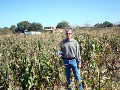
 We were able to show Flat Stanley that we have corn fields here in Calama too!
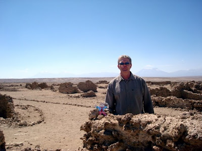
 This photo is one of many that demonstrate how barren the Atacama Desert is. The Atacama lies west of the Andes and east of the Chilean Coastal Range contributing to this area being billed as the driest desert in the world. The Atacama has been used for filming Mars scenes.
 We took Flat Stanley to visit the San Francisco de Chiu Chiu Church which was constructed during the 17th century. Following are photos from inside the church. The roof beams are constructed from cactus and the walls are approximately 1 meter thick (a bit over 3 feet.)


 We traveled from the church to Pukara Chiu Chiu which was a "fort" constructed between 800 and 1400 A.D.
 We continued north on the road entering a canyon which the Rio Loa flows through ultimately arriving at Pukara de Lasana -- another pre-Inca "fort" constructed during the 12th century and restored during the 1950s. These two fellows asked if they could have their pictures taken with us. We agreed if they would let us photograph them with Flat Stanley.
 Another example of the barren Atacama Desert.
 This photo shows San Pedro (left) and San Pablo in the background with the green Rio Loa valley in the center of the photo and the stark comparison of that valley and the surrounding desert.
 My fellow Calama buddies and I decided to take you on a tour of Calamaland. This cool fellow greets everyone as they leave the airport.
Speaking of the airport....
 I can't brag about air quality in Calama. Below is a photo of the government run mine called Chuquicamata with a claim as the largest open-pit mine in the world. "Contemporary" construction began in 1911. It spews sulfur dioxide but the wind is generally blowing away from town -- whew! Because the mine is run by the government and because it is so old, it isn't required to follow the same environmental standards as newer mines. Chuqi is about 20 miles outside of Calama and employs quite possibly around 10,000 Calamenos. Calama's population is around 150,000. The elevation here is approximately 7500 ft.
 Here is a photo of our favorite restaurant -- Patagonia. Great steaks!
 The statue of Christ in the background was erected in September 2008 -- just before our arrival. You'll notice the artistic attempt here with the beer bottles in the foreground.
 We visited one of the cemeteries -- interesting. There are flower vendors just outside the entrance. Families visit the cemetery on weekends and always bring flowers.
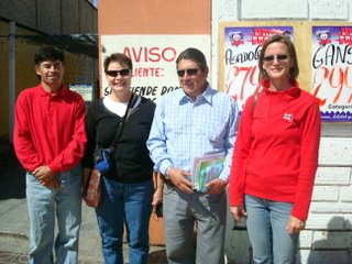
 Here we were out on the town and ran into Jorge (left, who takes care of all the plumbing needs) and Alfonso (who takes care of any electrical problems where we live.) That is Odessa on the left and Tracey on the right.
 A fountain along the pedestrian walkway.
 La Iglesia Catedral San Jaun Bautista built in the early 1900s and remodeled in 2000.

 The Bookstore!
 Here we are at the meat store. Tracey was buying a bone for her dog. By the way, I don't buy my meat here.
 So, the best place for purchasing fruits and vegetables is the Feria Modelo and the traveling Feria but for grocery shopping -- we go to Lider! We park in the underground garage (which is always a tad uncomfortable because I think we have too many earthquakes (Calamenos call them "tremblers" which I think to them is anything less than a 6.0!). Anyway, we park and then jump on the moving sidewalk taking us up to the grocery store. These walkways are magnetized so you don't have to worry about your full cart rolling on your way back to your car.
 FYI: this is where we buy our meat. You are to tip the young people who bag your groceries. We've heard that Safeway is somehow associated with Lider which may explain why we're seeing so many Safeway brand products on the shelves -- woohoo -- chocolate chips and marshmallows! I'm so easily pleased these days....
 The circus came to town -- always blowing dust. No we didn't go.
