 This is our house. I'm standing in the road to our house near our neighbor's driveway. We also have a neighbor across from us and behind us. The other side of our property has a security fence between us and the river, El Rio Loa.
 This photo is taken standing in our yard and looking back from where the previous picture was taken.
 This is a front view of the house. To the right is the fence and then the river.
 This is the view from our front door and looks at the back of our neighbor's house which is where my exercise buddy Odessa lives.
The gardeners take care of all the yards and mow once a week.
 This is the view looking at the front of our house and looking to the right where the security fence is and the river.
 This is a picture of the "river" where people gather on the weekends to camp and party.
 This is the view when you walk in the front door. The kitchen is to the immediate left and the dining room is the second door and after the dining room door is the entrance to the living room.
 This is the inside garden. The waterfall (that stack of rocks in the corner) does work but you have to keep the hose running in it as it doesn't recirculate but instead drains immediately.
 This is our living room. We got the fake tree at the South American version of Home Depot. Don't let that furniture fool you -- it may look nice but to sit on it -- it is hard as a rock.
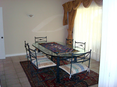
 This is the dining room. Larry uses it for Spanish classes on Sat. a.m. We've yet to eat in there.
 This is our kitchen. The dishwasher is below the oven. The oven has been converted from a 110 v appliance to a 220 v. I was having trouble baking and ultimately was told that because the oven was converted, I was suppose to be using "timed bake" instead of "bake". When I was using "bake" the oven was essentially working as a broiler from the bottom burner. We're also not able to calibrate the heat correctly so I now know (with the help of an oven thermometer) to set the oven at 300 if I want it to cook at 350. No wonder I was having trouble with my cookies when I set the temperature at 350 and it was cooking them at 400!
 This is a picture we took upon our arrival and demonstrates the lack of height on our kitchen counters.
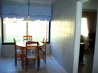
 This is our little kitchen eating area showing the entrance to the office to the right.
 This is the "office" area with a sliding glass door leading to the enclosed patio area.
 This shows the view from the back of the house. We were provided with that neat table but the chairs (which are being used outside to protect the herb seeds I planted from Daisy --you'll see her picture shortly), didn't have any cushions and we aren't able to find any here for the chairs. Thank goodness for the South American version of Home Depot where we bought a couple chairs complete with cushions! We've also bought the plants you see on the left of the patio.
 These big windows open like a sliding glass door so we open them when we barbecue. The roof is made of fiberglass with a trellis-type material over that. A lot of dust, etc., does come in here.
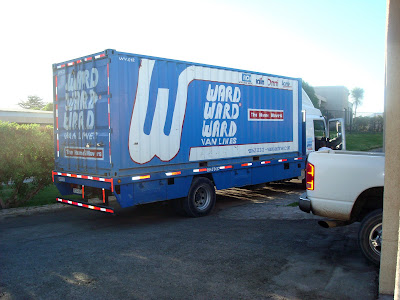
 Here was the truck that finally delivered our "air" shipment 7 weeks after we had arrived. There was one 4x4x4 box in this truck which had driven from Santiago to deliver the "air" shipment. They arrived at around 7 p.m. on a Sunday. We were glad to finally get our "stuff".
 This is Daisy. She was taken in as a puppy by a former expat who made arrangements for her care when he left. She has a dog house up by the guard shack and they feed her up there. She has adopted us though so spends a lot of time at our house. Larry thinks this is the perfect way to have a dog!
This is the gymnasium. It is located in the compound.
 This is where I spend each weekday morning. My new favorite exercise machine is the eliptical. Larry gets up at 4 a.m. on Wednesday to use the gym before going to work and is able to use it as well on the weekend. We really appreciate it!
 This is where I spend each weekday morning. My new favorite exercise machine is the eliptical. Larry gets up at 4 a.m. on Wednesday to use the gym before going to work and is able to use it as well on the weekend. We really appreciate it!
Okay, now you have an idea of where we live.


 Our next excursion was a trip to the


